

Aviation LiDAR Systems
3D scanning wind LiDAR for airport wind shear detection, low-level wind shear alerting, runway wind profiling, and aviation safety applications.
Aviation Wind Sensing for New Zealand
Geospace NZ is the New Zealand distributor for the Leice Aviation LiDAR range — providing 3D scanning Doppler wind LiDAR systems for airport wind shear detection, low-level wind shear alerting systems (LLWAS), runway wind profiling, and aviation meteorology.
Leice aviation LiDAR systems are deployed at major international airports and aviation authorities worldwide, delivering real-time wind field data to improve flight safety, reduce go-arounds, and support air traffic management decisions.
3D Scanning Wind LiDAR
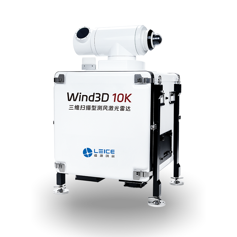
Wind3D 10K
Scan Range
Up to 10 km
Wind Speed Accuracy
±0.3 m/s
Scan Modes
PPI / RHI / DBS / VAD
Wavelength
1.5 μm (eye-safe)
Operating Temp
-40°C to +50°C
IP Rating
IP65
- Full 3D wind field scanning up to 10 km for airport coverage
- Wind shear, microburst, and wake turbulence detection
- Multiple scan modes: PPI, RHI, DBS, VAD
- Real-time wind field visualisation for air traffic management
3D Scanning Wind LiDAR
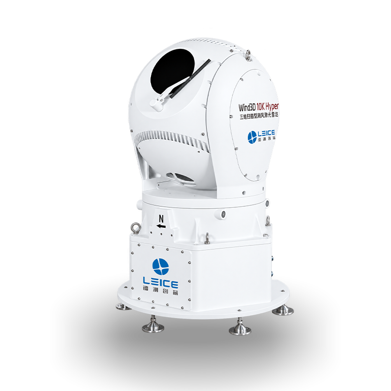
Wind3D 10K Hyper
Wavelength
1550 nm, eye-safe
Detection Range
30 m – 30 km
Wind Speed Accuracy
≤0.1 m/s
Azimuth Scan Range
0° – 360°
Elevation Scan Range
-40° – 190°
Wind Speed Range
0 – 75 m/s
- 30 m – 30 km detection range — maximum airport coverage
- Full 360° azimuth scanning for complete runway approach coverage
- Wind speed accuracy ≤0.1 m/s for precision aviation alerting
- Detects wind shear, microbursts, and low-level turbulence
3D Scanning Wind LiDAR
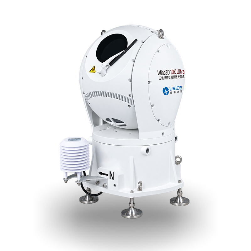
Wind3D 10K Ultra
Wavelength
1550 nm, eye-safe
Wind Field Detection Range
45 m – 20 km
Wind Speed Accuracy
≤0.1 m/s
Pointing Accuracy
≤0.03°
Scan Range (Pitch)
-25° to 190°
Depolarization Range
Vertical >2 km; Horizontal >5 km
- 45 m – 20 km wind field detection for full approach path coverage
- Integrated weather station sensor arm for surface met data
- Depolarization ratio measurement for fog and precipitation detection
- Wind speed accuracy ≤0.1 m/s, pointing accuracy ≤0.03°
3D Scanning Wind LiDAR
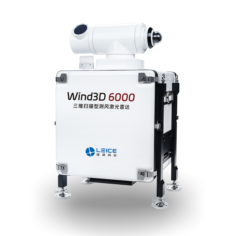
Wind3D 6000
Scan Range
Up to 6 km
Wind Speed Accuracy
±0.3 m/s
Scan Modes
PPI / RHI / DBS / VAD
Wavelength
1.5 μm (eye-safe)
Operating Temp
-40°C to +50°C
IP Rating
IP65
- 6 km range 3D scanning for regional and smaller airport deployment
- Wind shear and turbulence detection on approach and departure paths
- Compact and cost-effective for airports with shorter runway coverage needs
- Multiple scan modes for flexible operational configurations
Partners & Supported Software

Enquire About Leice Aviation Systems
Contact Geospace NZ to discuss your airport wind sensing requirements, request a demonstration, or obtain pricing for any Leice aviation LiDAR system.
Get in Touch