
GreenValley International — NZ Distributor
Greenvalley International LiDAR
Vehicle-mounted, handheld, and UAV LiDAR systems from GreenValley International. Geospace NZ is the authorised New Zealand distributor for the full GVI hardware and software range.
Enquire via Geospace NZVehicle-mounted mobile scanning
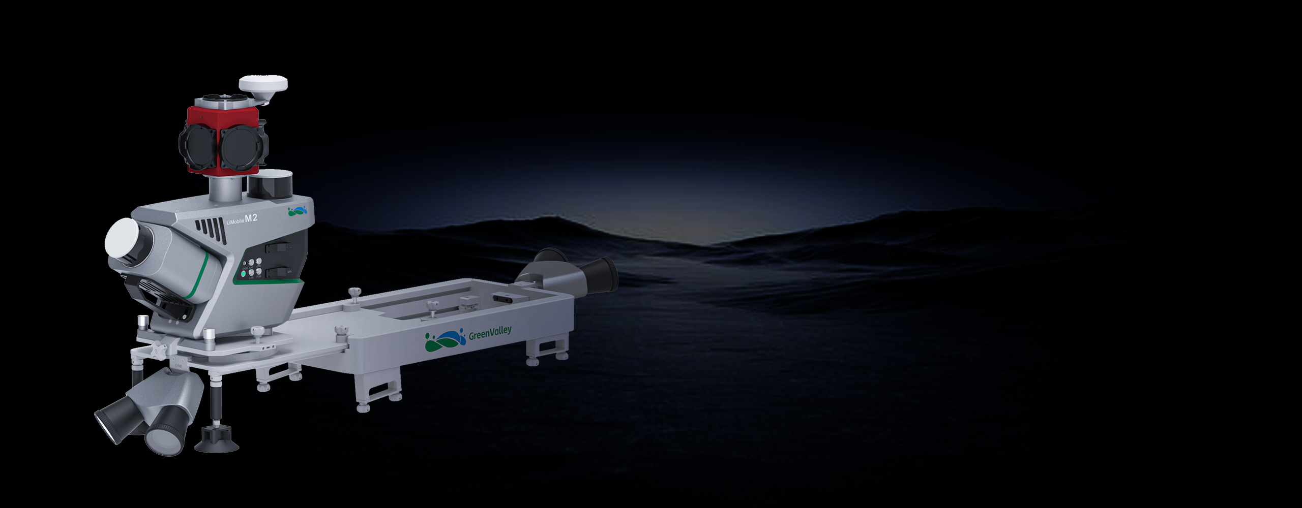
LiMobile M2 Series
Four tiers of vehicle-mounted mobile laser scanning — from cost-effective entry to ultra-high-precision survey grade. All models pair with LiDAR360 MLS for end-to-end data processing.
The LiMobile M2 integrates dual LiDAR (30° tilted/horizontal) and a Ladybug5+ panoramic camera for 3D road and environment mapping. Using laser SLAM, it achieves high-precision GPS-denied scanning. Paired with LiDAR360 MLS, it enables end-to-end data processing for road asset extraction, urban powerline analysis, forestry management, and smart transportation.
Key features
- Full-scenario SLAM — stable in GNSS-denied environments
- Seven predefined mounting angles (0°, ±15°, ±30°, ±45°)
- Quick-release design for rapid installation and removal
- Optional pavement camera, front camera, Ladybug6, DMI
- Real-time data monitoring via GreenValley collection APP
- External power supply for uninterrupted operation
Key specifications
Range
300 m
Scan rate
1,280,000 pts/s (Dual Return)
Absolute accuracy
≤ 5 cm
Panoramic camera
30 MP Ladybug5+
Application scenarios
GNSS · RTK · SLAM
Handheld Scanning
Compact, operator-held LiDAR scanners with integrated GNSS, RTK, and SLAM positioning. Survey-grade point clouds without a vehicle or backpack — ideal for indoor spaces, complex structures, and rapid field capture.
 Professional
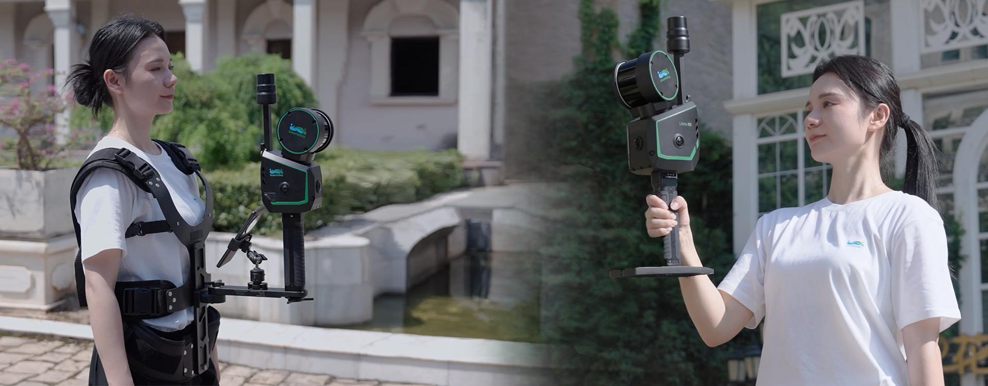
LiGrip 02
Professional Handheld & Wearable SLAM LiDAR
The LiGrip 02 is a versatile professional-grade handheld LiDAR scanner that can also be worn via a harness for hands-free operation. It combines SLAM positioning with optional GNSS/RTK for seamless indoor-outdoor transitions, delivering centimetre-level accuracy across buildings, infrastructure, and outdoor environments.
- Dual-mode: handheld or wearable harness for hands-free scanning
- SLAM + GNSS/RTK fusion for seamless indoor-outdoor transitions
- Centimetre-level accuracy in GPS-denied environments
- Compact and lightweight for rapid deployment
- Suitable for buildings, tunnels, infrastructure, and outdoor terrain
- Compatible with LiDAR360 for end-to-end point cloud processing
Positioning
SLAM + GNSS/RTK
Use modes
Handheld & wearable harness
Environments
Indoor & outdoor
Accuracy
Centimetre-level
 Lightweight
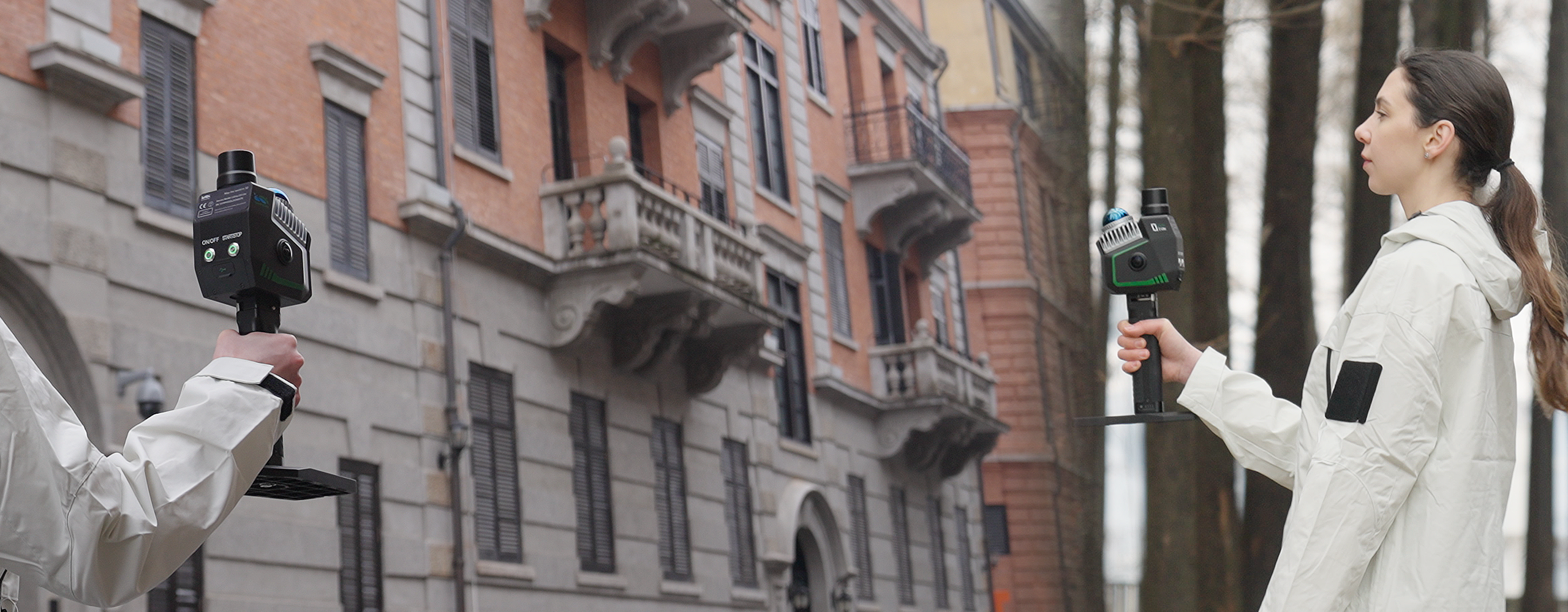
LiGrip 02 Lite
Lightweight Handheld SLAM LiDAR Scanner
The LiGrip 02 Lite is a compact, cost-effective handheld SLAM LiDAR scanner designed for everyday field capture. It delivers reliable SLAM-based positioning in GPS-denied environments and is ideal for indoor mapping, heritage documentation, and urban surveys where portability and ease of use are priorities.
- Ultra-compact form factor — easy one-hand operation
- SLAM positioning stable in GPS-denied indoor environments
- Rapid setup — scan within minutes of arrival on site
- Ideal for indoor mapping, heritage, and urban surveys
- Cost-effective entry into professional handheld LiDAR
- Compatible with LiDAR360 for full point cloud processing workflow
Positioning
SLAM
Form factor
Compact handheld
Environments
Indoor & outdoor
Design
Lightweight & portable
 RTK Precision
LiGrip SE
Precision Handheld LiDAR with GNSS & RTK
The LiGrip SE is a high-precision handheld LiDAR scanner with integrated GNSS and RTK positioning for survey-grade outdoor accuracy. Its ergonomic handle makes it ideal for open-air surveys, road asset capture, and any application where absolute geo-referenced accuracy is required.
- Integrated GNSS + RTK for absolute geo-referenced accuracy
- Survey-grade precision for outdoor asset capture
- Ergonomic handle design for extended field use
- Ideal for road surveys, open terrain, and infrastructure inspection
- Lightweight body for all-day portable operation
- Pairs with LiDAR360 for complete data processing pipeline
Positioning
GNSS + RTK
Accuracy
Survey grade
Best for
Outdoor geo-referenced surveys
Form factor
Ergonomic handheld
Drone-mounted LiDAR payloads
UAV Scanning
Drone-mounted LiDAR payloads for aerial survey, corridor mapping, forestry, and terrain analysis. From compact lightweight sensors to high-precision long-range systems — all compatible with LiDAR360 for end-to-end processing.
 600 m Range
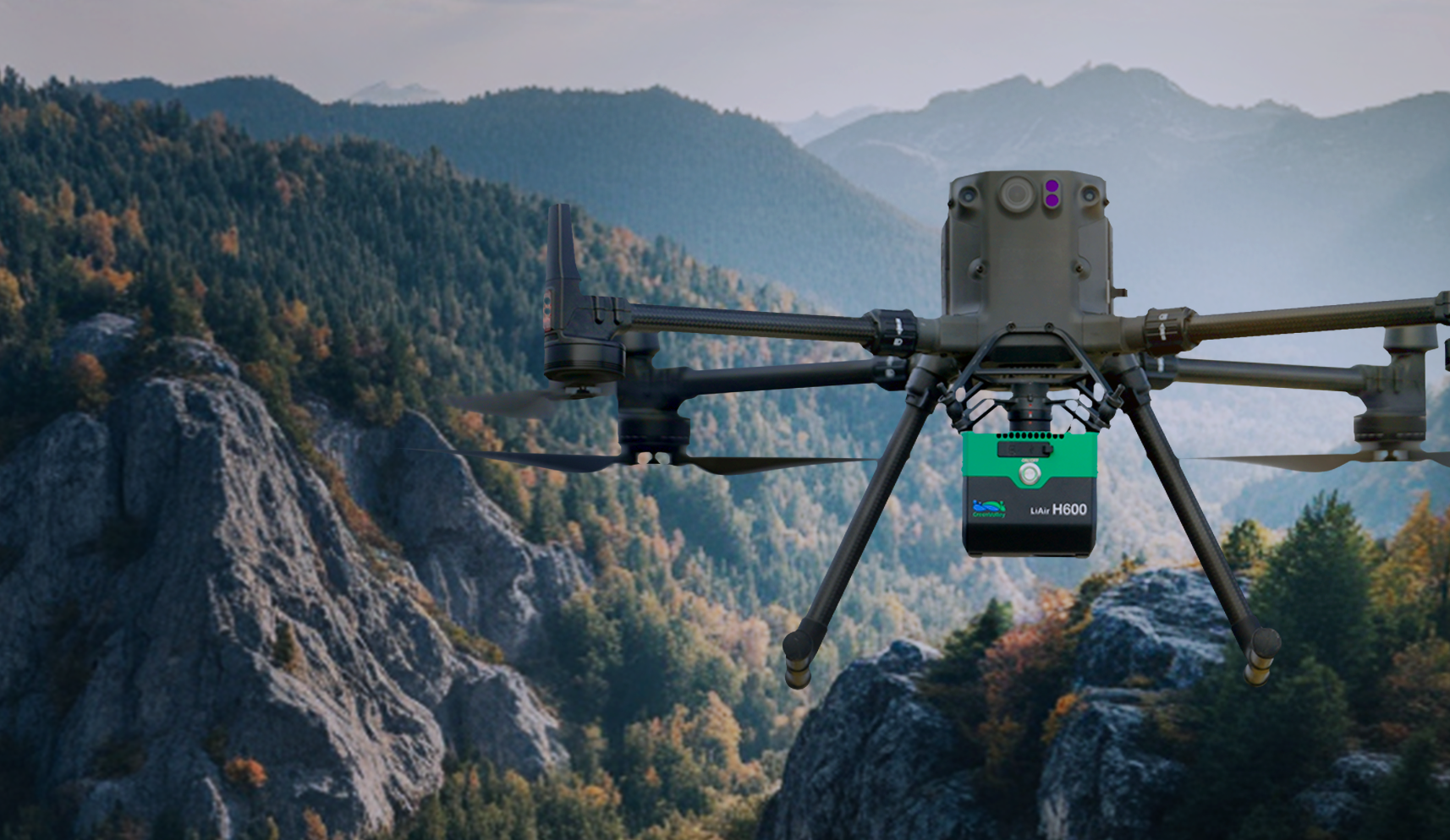
LiAir H600
Heavy-Duty UAV LiDAR Payload
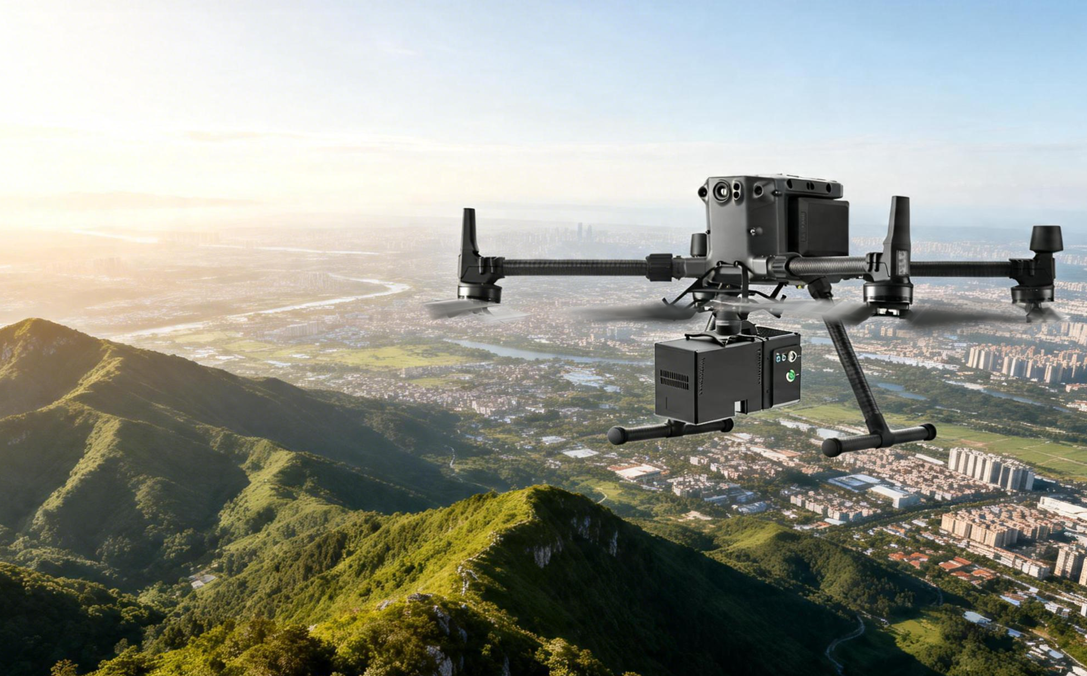
The LiAir H600 is a high-performance UAV-mounted LiDAR payload designed for large-scale aerial surveys. With a 600 m range and high-density point cloud output, it is suited to corridor mapping, powerline inspection, forestry, and terrain modelling across wide areas.
- 600 m range for wide-area and high-altitude surveys
- High-density point cloud output for detailed terrain models
- Suited to powerline inspection and corridor mapping
- Compatible with heavy-lift UAV platforms
- Integrated IMU and GNSS for direct georeferencing
- Processes directly in LiDAR360 MLS software
Range
600 m
Platform
Heavy-lift UAV
Best for
Large-scale aerial survey
Applications
Corridor, forestry, terrain
 Pro
ProLiAir H600 Pro
Professional UAV LiDAR with Extended Capability
The LiAir H600 Pro builds on the H600 platform with enhanced sensor performance and expanded integration options. It delivers survey-grade aerial point clouds for infrastructure inspection, urban digital twins, and large-area topographic mapping.
- Survey-grade aerial point clouds for professional applications
- Enhanced sensor performance over the standard H600
- Ideal for urban digital twins and infrastructure inspection
- Large-area topographic mapping capability
- Direct georeferencing via integrated IMU and GNSS
- Full LiDAR360 MLS software compatibility
Range
600 m
Grade
Survey grade
Best for
Urban mapping & infrastructure
Integration
Extended sensor options
 800 m Range
LiAir H800
Long-Range High-Precision UAV LiDAR
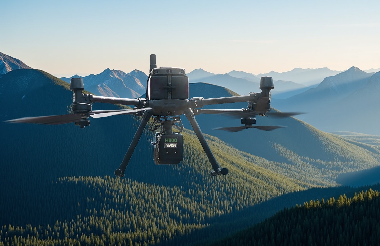
The LiAir H800 is a long-range, high-precision UAV LiDAR payload for demanding aerial survey applications. With an 800 m range and millimetre-level accuracy, it excels at large-scale topographic surveys, forestry inventory, and corridor mapping over challenging terrain.
- 800 m range — longest in the LiAir H series
- Millimetre-level LiDAR accuracy for demanding surveys
- Excels over challenging terrain and dense forest canopy
- Forestry inventory and biomass estimation capability
- Corridor mapping for powerlines, roads, and pipelines
- Compatible with LiDAR360 for complete processing pipeline
Range
800 m
Accuracy
Millimetre-level
Platform
Hexacopter / heavy-lift
Best for
Large-scale topographic survey
 Compact
LiAir X Mini
Compact Lightweight UAV LiDAR Payload
The LiAir X Mini is a compact, lightweight UAV LiDAR payload designed for small and medium drones. It delivers high-density point clouds for forestry, agriculture, and inspection applications where payload weight is a constraint.
- Ultra-compact design for small and medium UAV platforms
- High-density point clouds despite minimal payload weight
- Ideal for forestry canopy mapping and agriculture
- Rapid deployment for inspection and monitoring missions
- Broad drone platform compatibility
- Full LiDAR360 processing pipeline support
Form factor
Ultra-compact
Platform
Small & medium UAV
Best for
Forestry, agriculture, inspection
Weight
Lightweight payload
 Modular
LiAir X3C
Precision UAV LiDAR Sensor Module
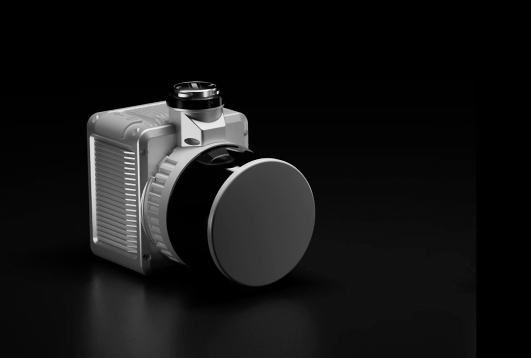
The LiAir X3C is a precision UAV LiDAR sensor module with a compact aluminium body. Designed for integration onto a wide range of UAV platforms, it delivers accurate point cloud data for survey, inspection, and mapping applications.
- Compact aluminium body for robust field performance
- Wide UAV platform compatibility for flexible integration
- Accurate point cloud output for survey and inspection
- Modular design simplifies mounting and maintenance
- Suitable for mapping, inspection, and monitoring missions
- Processes directly in LiDAR360 MLS software
Body
Compact aluminium
Integration
Multi-platform UAV
Best for
Survey, inspection, mapping
Design
Modular sensor unit
 Field Ready
LiAir X3-H
Field-Ready UAV LiDAR Payload
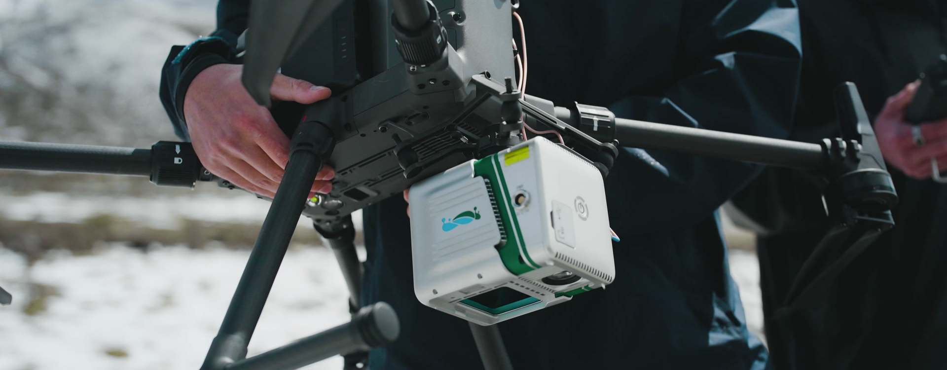
The LiAir X3-H is a field-ready UAV LiDAR payload with a distinctive white GVI housing. Designed for rapid mounting and dismounting in the field, it is suited to survey, inspection, and mapping missions in demanding outdoor conditions including snow and cold environments.
- Rugged housing for demanding outdoor and cold-weather operations
- Rapid field mounting and dismounting for efficient workflows
- All-weather performance including snow and cold environments
- Suited to survey, inspection, and monitoring missions
- Compact form factor for flexible UAV integration
- Compatible with LiDAR360 for end-to-end data processing
Housing
Rugged field-ready
Mounting
Rapid field attach/detach
Environments
All-weather outdoor
Best for
Survey & inspection missions
 Multi-Return
LiAir X4 Plus
Advanced Multi-Return UAV LiDAR System
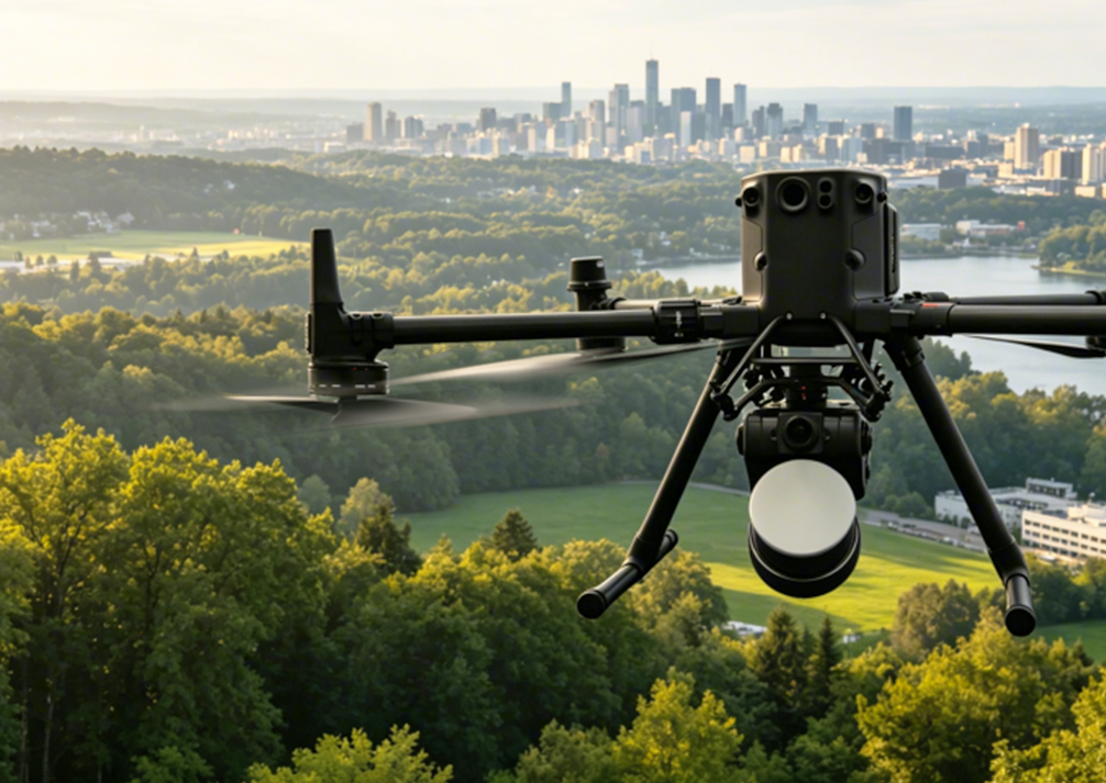
The LiAir X4 Plus is an advanced UAV LiDAR system with multi-return capability for penetrating dense vegetation and capturing complex scenes. It delivers high-density point clouds for urban mapping, forestry, and infrastructure inspection from the air.
- Multi-return capability penetrates dense vegetation canopy
- High-density point clouds for complex urban and forest scenes
- Ideal for urban mapping, forestry, and infrastructure inspection
- Advanced signal processing for accurate ground returns
- Compatible with a wide range of UAV platforms
- Full LiDAR360 MLS software processing support
Returns
Multi-return
Best for
Urban mapping & forestry
Point density
High-density output
Scenes
Complex & vegetated
Enquire about GreenValley International in New Zealand
Geospace NZ is the authorised New Zealand distributor for GreenValley International hardware and software. Contact us for pricing, demos, and technical support.